Great Outdoors Orange County/Long Beach presents
Mt Hood Timberline Trail Backpack
Sept 14 – 17, 2024
Contact Trip Leader: Larry Purtle: E-Mail: [email protected] Mobile: 562-485-7149
Timberline Trail, USFS Trail #600
The Timberline Trail is a National Historic Trail in the Mount Hood Wilderness that was constructed primarily by the Civilian Conservation Corps in the 1930s at the same time as the Timberline Lodge. It follows near the tree line and circumnavigates Mt. Hood with vistas, waterfalls, alpine meadows and west side Cascade forests.
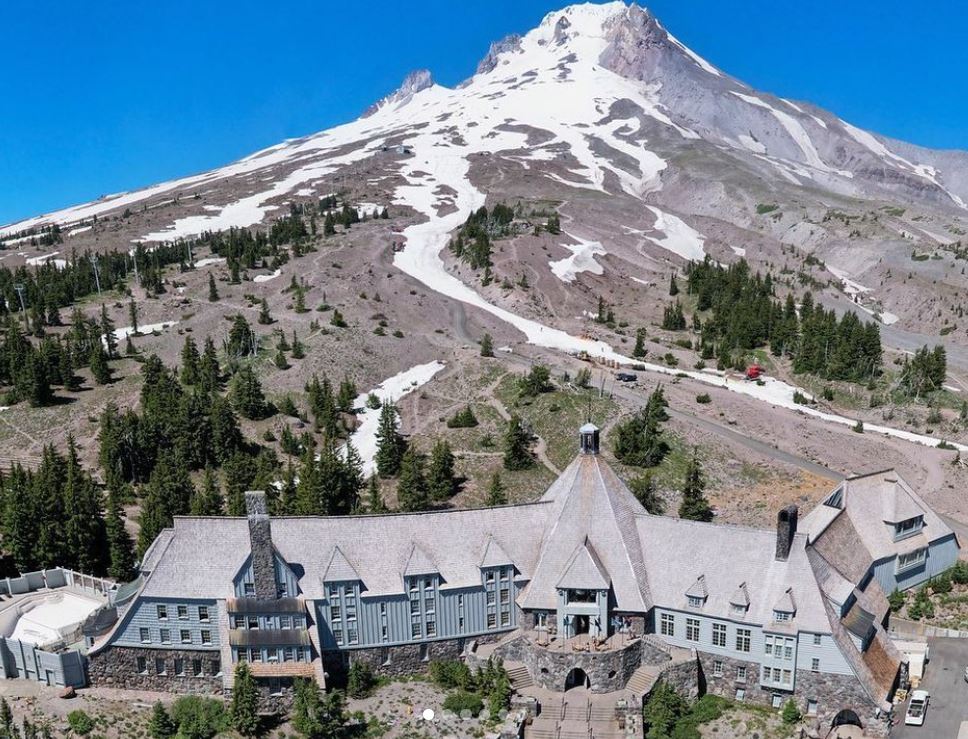
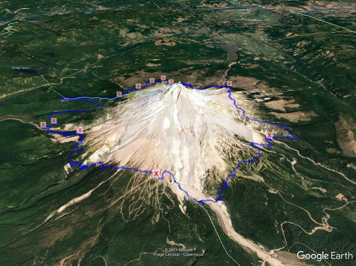
Our plan is to start and end the 4-day, 3-night hike at the historic Timberline Lodge on the south flank. Each day covers about 10 miles. It is rated as difficult but reviews indicate various skill levels complete it with no problems. There are detours required for blown down trees, mostly on day 2 before Bald Mountain. There are multiple glacial river crossings. Seasonal conditions should be fairly dry but conditions are variable.
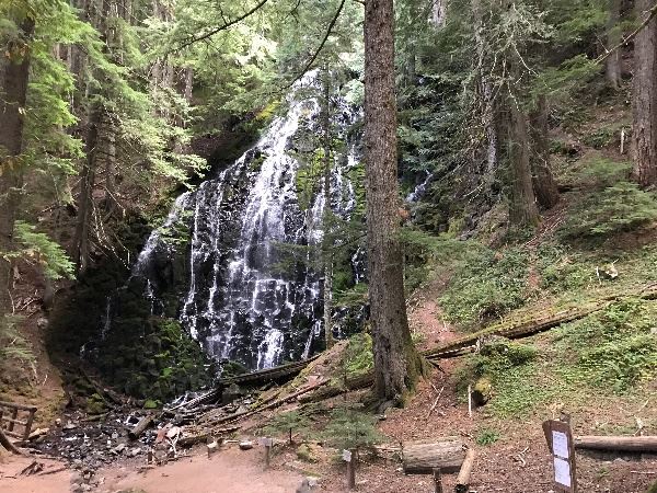
Day 1 will start at 8am from Timberline Lodge and follow west along the PCT to Ramona Falls near the Sandy River ravine on the western flank of Mt Hood. This day will require crossing the Zigzag and the Sandy rivers.
Day 2 From Ramona Falls we will continue west on the Ramona Falls Trail and then North on the PCT as a bypass of the original route along Yokum Ridge to Muddy Fork made difficult by blown down trees (2020 Labor Day storm). We’ll leave the PCT at Bald Mountain to rejoin the original Timberline Trail and head NE. We will cross the Muddy Fork, McGee, Glisan and Ladd Creeks. The day ends on the north flank at either Wyeast Basin Meadow or Elk Grove Camp.
Day 3 reaches the highest point, 7330 ft on the Copper Spur, on the eastern flank. The day starts with a crossing of the Coe Branch creek, and later crossing the Compass Branch, Elliot and Newton creeks. The route continues past the Cloud Cap ski area turning South to Gnarl Ridge, and we’ll spend the third night after crossing Newton creek.
Day 4 takes us back to Timberline Lodge, passing through the Mount Hood Meadows ski area, and climbing through the White River Glacier ravine. The main river crossings are Clark Creek and the White river.
-
Each participant is responsible for their own transportation to and accommodations at the trailhead.
-
Each participant is responsible for their own food and gear.
-
Each participant will need to bring the ten essentials as listed on GO website.
-
Sorry, no pets are allowed on this trip.
Please contact the trip leader for an application.
|
|
Day End
|
Altitude
|
Mileage
|
Latitude / Longitude
|
|
0
|
Timberline Lodge (Start/End)
|
5971
|
0
|
45.331309, -121.711307
|
|
1
|
Ramona Falls or adjacent camps (#1)
|
3420
|
10
|
45.37863, -121.78341
45.37863, -121.78341
|
|
2
|
Wyeast Basin Meadow or
Elk Grove Camp (#2)
|
5656
5458
|
19.2
21.6
|
45.35327, -121.648
45.40992, -121.6983
|
|
3
|
Camp site past Gnarl Ridge and Newton Creek (#3)
|
5403
|
33.6
|
45.35327, -121.648
|
|
4
|
Timberline Lodge
|
5971
|
41.3
|
45.331309, -121.711307
|
Additional Information:
Click here for USFS.
Click here for Oregon Hikers.