THIS HIKE HAS BEEN CANCELLED
Due to highway closures, rain and snow impacts, and needing to let the trail recover, this Switzer's Falls hike is cancelled. Please check back for updates on upcoming March hike dates. We may end up having to change plans for those as well.
Stay safe out there and please be patient as public agencies deal with the aftermath of all of this rain and snow.
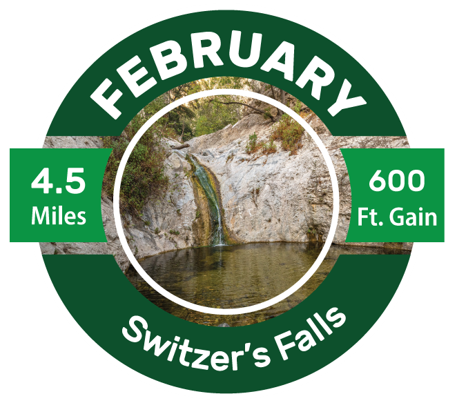
Switzer’s Falls – March 5 2023
Great Outdoors LA kicks off our year full of hiking with one of the most popular routes in the San Gabriel Mountains – the Switzer Falls hike. This moderate difficulty trek takes in a variety of habitats and has some truly epic views of a landscape which has mostly recovered from the 2009 Station Fire.
WHERE and WHEN: We’ll meet at 7:00 AM at Switzer’s Picnic Area on the Angeles Crest Highway (CA-2), roughly 10 miles north of La Cañada Flintridge and about a half mile past the intersection with the Angeles Forest Highway. Turn right and drive down the steep switch-backed slope to the large parking lot at the bottom.
Be sure to have either a daily or an annual Adventure Pass visible in your car to park at Switzer’s. Yes, 7:00 is early… did we mention this hike is really popular? Getting there early makes it a safer bet that everyone will get a parking spot in the lot.
Return time of 2:00 PM is a preliminary estimate.
CARPOOL MEET-UP?: We also encourage folks to consider meeting in La Cañada Flintridge at 6:30 am and carpooling from there. A great meeting/parking area is located around 940 Chehalem Rd, La Cañada Flintridge, CA 91011. As always, don’t leave valuables in your parked car in either location.
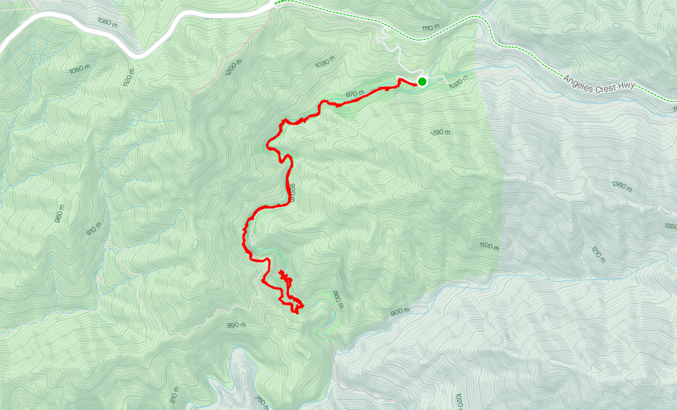
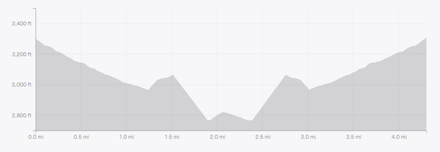
THE HIKE: The hiking route follows the Arroyo Seco gradually downward for about 1.25 miles but then ascends to the ridgeline above the waterfall. After another half mile, a steep side trail drops us back down to the river where we hike about a quarter mile back upstream to the waterfall. After taking a photo-and-snack break, we’ll backtrack to the parking lot for a total distance of about 4.5 miles and 600 feet of total elevation gain.
Dress in layers as it’s likely to be pretty chilly when we start but 20-30 degrees warmer on the exposed ledges at the top of the hike. As always on Great Outdoors hikes, we recommend having the ten essentials.
Reach out to trip leader Jeremy Munns to ask any questions. For photos and a much more detailed description click here.
Health Issues/allergies: It is the responsibility of participants to carry on their person a record of significant allergies, medications and medical history in the event of a medical emergency. Discuss any medical concerns with the hike leader if you wish.