SBVC – Hamilton Lakes Backpack (Strenuous)
June 25-28, 2020
Total Distance: 29 miles Elevation Gain: ~7000ft Route Type: Out and Back
Note: Potential attendees must be screened by trip leader prior to registration. The Strenuous rating of this trip is based on distance traveled from vehicles, terrain, elevation, elevation gain, and expected weather. Please contact the trip leader to discuss if this trip is right for you, and to obtain the registration code..
For burly hikers who like to push big miles with lots of elevation gain, Hamilton Lake is an incredible gem tucked away deep inside Sequoia National Park. It is a wonderful and pristine bit of alpine wilderness surrounded on all sides by massive rock faces reminiscent of Yosemite Valley, but at a much higher elevation.
The trek itself is full of true Sierra beauty in all of its forms. Massive waterfalls, rushing streams, huge cliff faces, and old-growth forests greet you along the 15-mile journey on the High Sierra Trail as we climb. Even the road to get to the trailhead offers some of the best of what Sequoia National Park has to offer – massive trees like something out of Jurassic Park tower all around as we park our vehicles and begin our adventure.
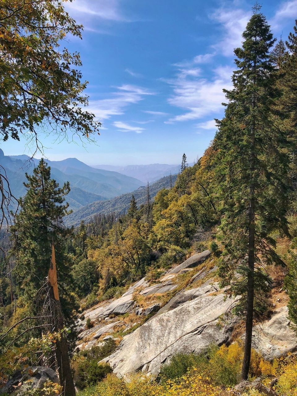
The trail from Crescent Meadow starts out in a dense pine forest, carpeted by bright green ferns. Be on the lookout for bears in the first few miles of the hike because they are a common sight, especially in summer months. Pretty soon, the path spits hikers out of the forest and onto a steep slope with panoramic views of Castle Rocks, Moro Rock, and the Great Western Divide. From here, the trail follows a gently-graded slope for the first few miles, dipping in and out of tree cover and breathtaking views of the massive peaks of the Great Divide.
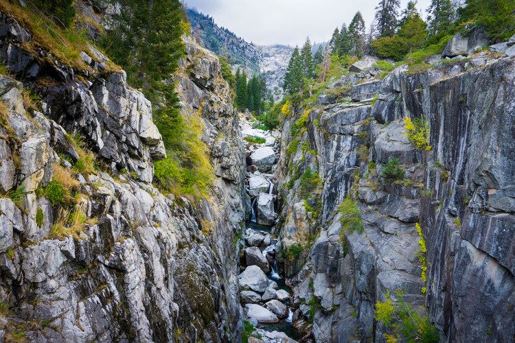
Along the trail, there are many places filter water, as many prominent stream crossings lay along the way. Midway on Day 1, we’ll get to Mehrten Creek, 5 miles in, with its beautiful granite slabs and views of the middle fork of the Kaweah River. From here, the trail continues ascending toward the rushing Buck Creek and its wooden bridge, climbing one final, steep set of switchbacks before arriving at our first backcountry camp, Bearpaw Meadow. A seasonal High Sierra Camp (and a camping area for backpackers with bear boxes) exists here at Bearpaw, and the kitchen tent will happily sell tired trekkers a beer.
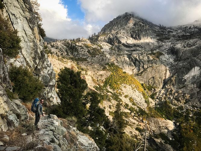
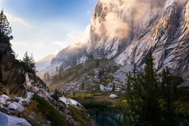
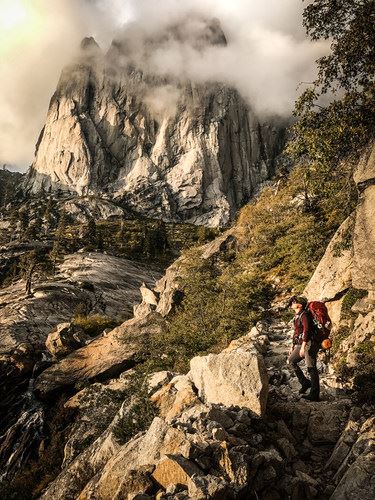
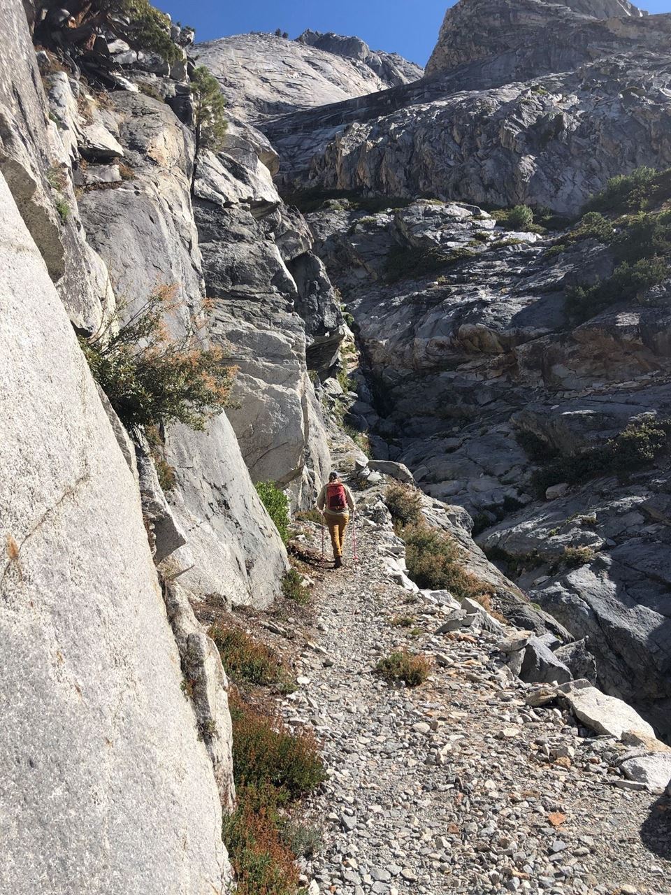
The next bit of the trail is the hardest yet, but the last push up to Hamilton Lake is well worth the effort. From Bearpaw Meadow, follow the trail down to Lone Pine Creek and across its large bridge that spans across a deep, rocky canyon. Then, head up a set of steep switchbacks that leads into the Great Western Divide. A 2,000-foot tall granite face named Valhalla soars overhead for the entirety of this climb, often obscured behind clouds due to the high elevation. The sheer magnitude of this feature is striking – it’s like El Capitan in Yosemite, only 4,000 feet higher up and far more secluded.
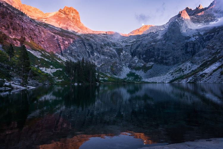
As we crest the last of the switchbacks, Upper Hamilton Lake will come into view with its sapphire-colored waters. The northwest corner of the lake features several designated campsites with wonderful views of the dramatic landscape. Sunsets at Hamilton are full of electric pinks and reds, so make sure to have your camera ready. The deer in this area are extremely friendly, and we might have to shoo them out of our campsite! We will use the bear boxes to put away any uneaten food and toiletries before turning in for the night.
Rest up well because on Sunday, we will eat breakfast, pack up camp, and hike the 14 miles back to our vehicles, along the same way we came in.
In order to acclimate to the elevation and allow folks time to group up, our first night will be car camping at Lodgepole Village (6700ft). The next morning, we'll eat a hearty breakfast and get on the trail by 9:00am to make the most of our day on the trail.
Thursday, 6/25: Drive to Lodgepole Camp for elevation acclimation. Many day hikes available.
Friday, 6/26: Breakfast, break camp and be at the Crescent Meadow trailhead ready to start hike at 9:00am. Hike 11 miles to Bearpaw Meadow High Sierra Camp
Saturday, 6/27: Breakfast, break camp and hike 4 miles to Hamilton Lakes
Sunday, 6/28: Breakfast, break camp and head 14 miles back to the trailhead
Weather: Expect warm days and chilly evenings and mornings. Dressing in layers is the best way to manage the possible range of temperatures. Precipitation is always a possibility, so rain gear is mandatory.
Bring: 10 Essentials (no kidding, every person needs a personal first aid kit); water filtration; food for each meal plus extra snacks; water bottle and filter system; sleeping bag and pad; tent; broken-in hiking boots; layered clothing; jacket; rain gear; wide hat; compass; toilet paper & trowel; compact camp stove; fire starter; headlamp; sunglasses; sunscreen; insect repellant; camera and entertainment (book, card game, etc). Topographic maps of the area will be provided at the trailhead.
Cost: $30. Backpacking permit for each person is included. Register early. Maximum 8 people. When capacity is reached, a waiting list will be in effect. Cancel before June 12 to receive a refund.
Other considerations: As with any backcountry experience, this one is "Leave no Trace" - our trash comes out with us. Active bear area - mandatory use of either bear cannisters or backcountry food lockers. Pets not allowed.
Directions: I-5 North to CA-99 North. Take exit 30 toward CA-65N/Porterville Hwy. After 55 miles, turn right onto Rd 204/N Spruce Ave, and follow this for 4.4 miles. Continue onto 14th Ave E/S Spruce Rd for 3.5 miles. Turn right onto CA-198 E and drive for 45.5 miles. Carpooling is highly encouraged.
Trip Leader: Please contact Chris Fava at 805-509-8240 or at [email protected]